

Skiing Weatherman: Out Like A Lion
March Won’t Be Ending Spring-like.
Although I had good intentions, I must confess that I did not get on the snow in the past week. 65 degree temperatures here in Rhode Island early this week didn’t help to inspire, for sure. Much of the East has had a frustrating season, due to a lack of cold and snow, but the evolving pattern over the next several weeks is not going to please those ready to turn their backs on winter. The pattern is going to change to one that delivers cold and snow into the country, first into the West but also to the East, where the colder pattern will persist for a longer spell than we have seen since early winter. That is great news if you have plans to ski or ride Easter weekend!
In the short term, a massive high pressure center is going to deliver a seasonably cold weekend to the resorts in the Great Lakes and East. In the West, the best news is that the Tahoe area is going to receive heavy snow during the second half of this weekend into early next week. After a largely snow-free February, some lighter snow has fallen the past two weekends in the central Sierra but this event will deliver the load that the resorts really need. Amounts will range from 1 to 2.5 feet with this storm. Snow is headed for the northern Rockies this weekend, too, as this surface map from Sunday morning illustrates.

Next week will turn milder again in the East, but not to the extent that we saw earlier this week. The coastal system that impacts the Sierra this weekend will continue to rotate southeastward during the first half of next week, bringing snows to the southern Rockies. While the upper level trough that produces that snow favors the West, an upper ridge over the East will keep it mild and deflect a storm up through the Great Lakes late in the week, and that track will be unfavorable for snow in the East.
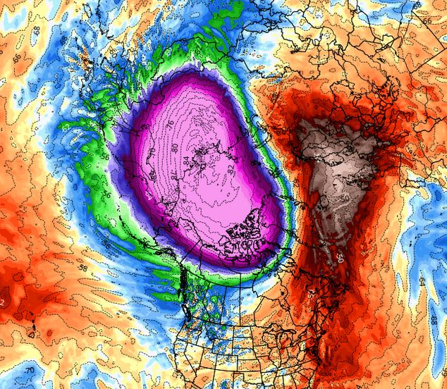
Help is on the way to the East, though, in a classic case of “better late than never”. Changes are underway in the Pacific in terms of the location of ridges and troughs, and we will soon see a configuration that has been rare this winter. An upper ridge will set up shop over Alaska, with a trough south of that spot. Here is forecast for the 22nd that illustrates the position of that ridge.
In addition to the strong ridge sitting over Alaska, notice the trough extending down from the southern flank of the polar vortex all the way to southern California…that will continue to benefit parts of the West. With a clockwise flow around the ridge and a counterclockwise flow around the trough, you can see how the air will be directed from the Yukon into the northern Plains and then eastward through the Great Lakes. As the trough presses eastward, it will spread the cold air into the East for the final week of the month and likely beyond. The season will roll along in the West, while in the East, don’t despair, a solid shot of cold and snow will set things up for some nice Easter sliding.
Here Are The Regional Details
Northwest U.S./western Canada: Light to moderate snow this weekend followed by several dry days next week. Light snows return Thursday, followed by a more substantial weekend storm.
Sierra: Good sized storm this weekend, the biggest since January. Next weekend looks promising, too. Longer term, eastern Pacific trough development will bring additional snows into April.
Northern Rockies: Moderate to heavy snow this weekend, light snows continue early in the week. Next shot at snow later next weekend.
Central and southern Rockies: Light to moderate snow this weekend, another shot at significant snow Tuesday as southern branch systems moves toward Four Corners.
Midwest: Nice weekend on the slopes. Light precip early next week, snow across north, rain south. Developing colder pattern will help sustain the season late month/early April.
Northeast/Quebec: Seasonably cold, dry weekend. Milder next week, not so much for northern New York and New England. Pattern change will make Easter viable for skiing, riding.


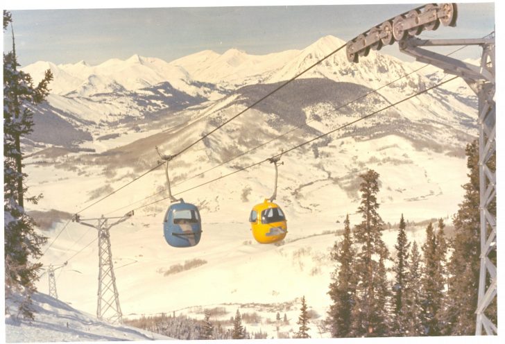

 This is a photo of
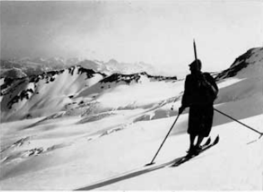


 Our Snow In Literature series features a Robert Frost poem that highlights the mischievous nature of the month of March. You’ll get a laugh at the last line. Kind of unusual for Robert.
 Skier hits boarder from behind. We have a new Incidents & Accidents report from reader Randall White who shows us a video of his collision with a snowboarder. Now, that’s a complete reversal of the kind of incidents we’ve been reporting. Find out why the collision happened. Randall did a great job analyzing the conditions that led to the impact.


 the venerable store near the mouth of Big Cottonwood Canyon, is an absolutely terrific place. Its location is ideal for people skiing Alta, Snowbird, Solitude or Brighton. It is consistently well-stocked with the top equipment and clothing brands. And the personnel are knowledgeable, helpful, and friendly. Years ago, when we visited with kids in tow, The Lift House is where we rented. Over the years, it’s one of the places I’ve relied on for quality tunes. It’s the kind of place with a deep inventory of useful accessories And when they have a sale, they really mean it. Many people stop on the way to the mountain to purchase discount lift tickets. For example, a weekday at Snowbird costs $130. At The Lift House, it’s $97. An Alta day pass is $125. At The Lift House it’s $105, a better deal than the $119 if purchased directly from Alta online. There are other excellent shops in the area, most with similar brands, some specializing in only the most expensive ski and casual clothing. When headed in the direction of Big and Little Cottonwood Canyons, The Lift House is highly recommended.


 Yes, Lucille Ball visiting the