Tag Archive for: John Nelson

Jeeves, Bring Me Some Skis…

…And Boots. Ski Butler Service Takes The Schlep Out Of Ski Vacations. 

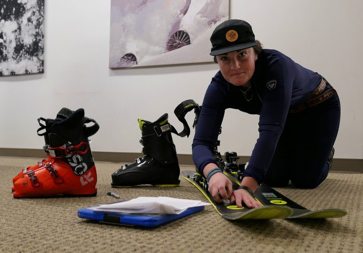
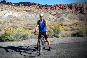
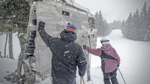
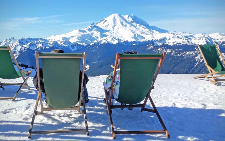
Maura Grady of Ski Butlers adjusts the bindings on Rossignol Soul 7 HD skis, one of the models the company offers. Credit: Jon Nelson

I’ve always wanted a butler. After watching all of those episodes of “Downton Abbey,” who wouldn’t?

And like the wise and efficient Carson on that popular TV show and movie, Ski Butlers offers an indispensable service, making the lives of traveling winter recreationists a whole lot easier.

Ski Butlers is a “come-to-you” ski and snowboard rental service that operates out of some of the largest markets in North America and Europe. Once you fly to a destination and check into your accommodations, Ski Butlers arrives with the gear, setting you up on site.

It’s a seamless operation.

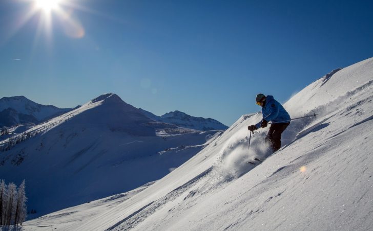
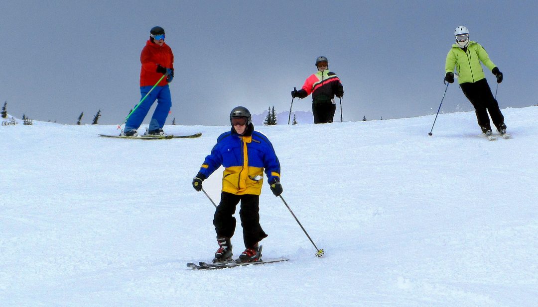
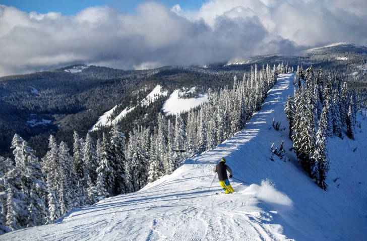
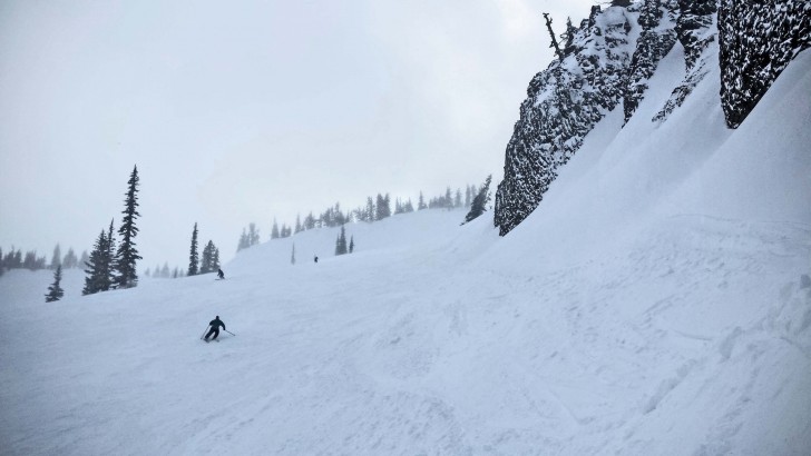
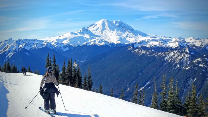
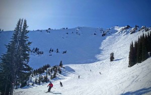
I used the service when I flew into Salt Lake City for a four-day tour of Wasatch resorts in mid-January. The Ski Butlers team brought everything —goggles, helmet, skis, boots and poles. I had requested a high performance package and got Rossignol Soul 7 HD skis, a model I’ve been wanting to try out for a couple of years.

Your first question might be, “How did they fit your boots?”

Maura Grady of Ski Butlers brought several different pairs of boots for me, finding the right-fitting performance Rossignol boots almost immediately. I even learned something from her after finding the right pair.

“Pull the power strap tightly above the top buckle to prevent bruising on your shins,” she said.

It worked. Thank you, Carson. I mean Maura!

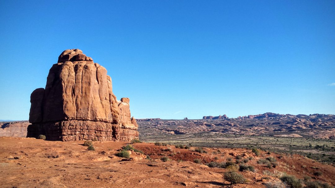
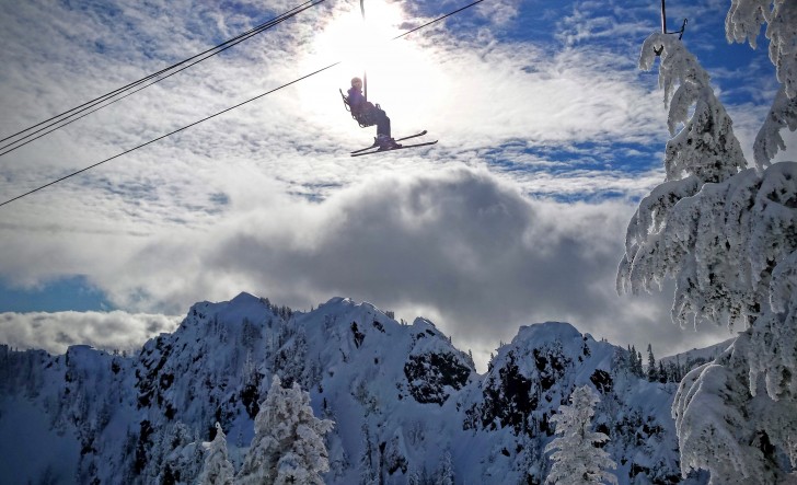
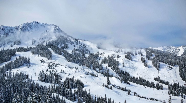
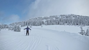
Once the boots were selected, Grady set the bindings, and I was good to go. The skis performed flawlessly during my tour of Alta, Snowbird, Solitude, Brighton, Snowbasin and Powder Mountain.

And let me also say this: The Soul 7s are a great ski for Utah’s amazing powder.

When it’s time to go back home, Ski Butlers picks up the gear, saving you another travel headache. All in all, it’s the easiest rental service I’ve ever used.

Ski Butlers started at Park City, Utah, in 2004, and has expanded to 50 destinations worldwide, concentrating on the Rocky Mountains and Western United States, said Nikki Bongaerts, senior content and communications manager.

The pricing for Ski Butlers depends upon the time of year, the type of package and the location, Bongaerts said, with rates going up during the busiest times of the year. She added: “Our prices are equal to or lower than the shop prices on the hill.”  

For example, base prices in Park City range between $51 per day for a “first-timer” package and $71 per day for a high performance package.

Some of the top markets for Ski Butlers are Utah, Summit County in Colorado, the Lake Tahoe area in California, Jackson Hole, Wyo., and Big Sky, Mont., Bongaerts said. Some Northeastern U.S. destinations may be added in the future, she added, depending upon demand.  

Besides the boot-fitting, the other main concern among customers is whether the gear will be beat up. No worries—the bases of my skis were perfectly tuned, thanks to Ski Butlers’ Montana tuning machine, a state-of-the-art robotic system.

Rather than schlepping your gear on an airplane, you might want to consider Ski Butlers in the future.

“The biggest advantage is the convenience factor,” Bongaerts said.

SeniorsSkiing Guide: Wolf Creek—The Snowiest Surprise

This Resort Has All The Characteristics Senior Skiers Love.

Skiing off the top of Wolf Creek, with Alberta Peak in the distance. Credit: Samual Bricker courtesy of Wolf Creek Ski Area.

It was a powder day at Colorado’s snowiest resort when we pulled in.

Where were the crowds? Not here, they were in places like Aspen, Vail, and Winter Park.

“There are maybe 500 people here,” said our shuttle driver. “Have fun!”

The unassuming base area at Wolf Creek Ski Area is a throwback, with no developed village. Credit: Samual Bricker courtesy of Wolf Creek Ski Area.

Wolf Creek Ski Area is a delightful throwback situated on the Continental Divide in the southern part of the state. And if you’re shocked at the price of skiing in Colorado’s glitzy mountain enclaves, you’ll be pleasantly surprised at how they hold the affordability line at Wolf Creek.

“We’re not out to squeeze every last dime out of our customers,” said Rosanne Haidorfer-Pitcher, vice president of marketing and sales at the resort.

Walk-up ticket prices are $72 for adults, and just $43 for seniors 65-79. If you’re 80, congratulations, your ticket is free.

The skiing is phenomenal, especially if you can hit Wolf Creek on a powder day, which is often. Rocky Mountain storms drop more snow here than anywhere else in Colorado—430 inches a year.

Tree-Skiing Paradise

A skier gets ready to drop in off of Knife Ridge, a short hike into double-diamond powder terrain. Credit: John Nelson

Wolf Creek has a vast array of tree-skiing runs scattered over its 1,600 acres. Topping out at 11,900 feet, its 10 lifts serve a long ridge line that is steep at the top, but rolls into intermediate pitches for most of the area. All in all, 55 percent of the mountain is rated as beginner and intermediate.

If you’re an advanced skier, hiking along the ridge line will deliver you into double-diamond alpine drops. Some of the best are off the Alberta Lift, where a 10-minute climb puts skiers into rare territory of steep untracked lines.

You’ll find great powder elsewhere at Wolf Creek, particularly in the resort’s vast maze of tree-skiing. During my visit in February, I skied powder all day.

Transportation, Where To Stay

Wolf Creek has no on-mountain village. It’s an unassuming collection of old-school lodges, with accommodations 23 miles to the west in Pagosa Springs and 18 miles east in South Fork. If you don’t want to drive, shuttle service is offered by Wilderness Journeys in Pagosa Springs.

Pagosa Springs offers the biggest variety of lodging and restaurants, and it’s also home to several hot springs establishments where you can soak your quads after spending the day skiing powder.

After our big powder day, we spent the shuttle ride down talking about how much we loved the skiing at Wolf Creek.

“This is my new favorite resort in Colorado,” said Jan Mosman, who was visiting from Minnesota with her husband, Mark. “I love the tree skiing.”

The Mosmans had just come from Winter Park, where they had done battle with 15,000 other skiers.

“What did you like best about Wolf Creek?” I asked them.

“No lift lines,” Mark said.

Food, Travel

For a small ski area, Wolf Creek has some surprising amenities. On mountain, there are eight places to eat.

The main Wolf Creek Lodge has daily hot specials and homemade soups, along with burgers served on the sundeck. Don’t miss the Continental Espresso Bar at the top of the Treasure Stoke lift, surely one of the highest places to get a coffee buzz in the Rockies.

The closest major airports to Wolf Creek are in Denver (246 miles away) and Albuquerque (237 miles away).

Click here for Wolf Creek Web Cam

Click here for Trail Map

Skiers make the 10-minute climb off the top of the Alberta Lift to access advanced terrain at Wolf Creek Ski Area. Credit: John Nelson.


The Archetype Senior Skier? This Guy Sure Looks The Part

74 Year Old Long Time Ski Host Books 120 Ski Days A Year At Big White. Jealous?

Ski Host Carlan Silha is fit and fortunate to ski so many days at 74.
Credit: John Nelson

It might seem strange that an American from the Spokane area knows this sprawling British Columbia ski resort better than just about anyone.

Carlan Silha has been serving as a snow host at Big White for 20 years, longer than anyone at the resort. The lanky 74-year-old still skis like a 24-year-old, kicking his heels when he takes a jump and issuing a frequent “Woo-hoo!” as he turns in powder.

The story of how Silha got to Big White starts in 1992, when he was a Boeing executive working in Europe. He and his wife Lin were looking for a condo at a ski resort, and a friend suggested Big White.

“We ended up buying because it was a great price,” Silha said. “Then we got here, and realized we really liked it.”

Silha eventually retired, moved from Seattle to the Spokane area, and then began spending every winter at Big White, where he became a snow host, showing visitors the ropes. Now he logs 120 ski days a year and relishes every minute.

“Let’s ski the Rat Trees,” Silha said as he showed around another visitor recently. The trees are so named because regulars have been hanging toy rats from a particular tree deep in the forest near Big White’s Powder Chair.

If you were Carlan, you’d have a big grin, too.
Credit: John Nelson

Silha then shot off, cranking precise turns through the trees in four inches of new snow. “Woo-hoo!” he shouted for perhaps the millionth time of doing this.

“Being outdoors keeps you young,” he said.

During summers, the Silhas spend their time fishing and camping, using Spokane as home base. They like to travel around the West, and Silha keeps fit by hiking and biking.

In winter, they hang out with ski friends who own condos at Big White, a large collection that includes Australians, Brits, Kiwis and, of course, Canadians. The snow host job—showing visitors around Big White’s 7,355 acres—keeps him busy and provides its own rewards.

“The main attraction is meeting people from all over the world,” he said. “And it makes you feel good to show people this mountain.”

Cycling Series: Around Old Seattle

Biking With A Mission: Hit The Historic Parts Of Town.

Editor Note: You can download a cue sheet for this “Forgotten Seattle Bike Tour” by clicking here which will take you to correspondent John Nelson’s blog. 

Start the ride at Occidental Park, once a salt marsh. Historic bike rides bring a new dimension to a city. Credit: John Nelson

It turns out the bicycle is a great time machine.

I recently devised a tour to take in some of Seattle’s most famous historic sites. You can do it too, no matter where you live. Using a bike and a little imagination, it’s fun to explore your city in different way.

Come along on my 23-mile tour back to the 1800s, and let’s see what was happening here in Seattle.

Pioneer Square

Our journey begins in Occidental Park. Today it’s a vibrant brick-covered gathering place, but when the first settlers came to Seattle, it was a salt marsh.

As we travel three blocks north toward Yesler Way, notice how wobbly the ground is. You can thank the workers of Yesler’s Mill, who started filling much of this ground with sawdust as the city was being built. Streets throughout this part of town are uneven and unstable, as fill material was added over the years, including the refuse from a major fire in 1889.

Shoreline to Denny Hill

Heading north along Western, imagine we’re traveling on the shoreline of Seattle. Back in the 1850s, this was the waterfront—none of those piers 300 yards to the west were here.

As we pass Spring Street, take a moment to look up the hill to the east. Nine springs provided water to the early settlers in the city, and Spring Street is named for the biggest of these. To appreciate this spot, let’s take a long drink from our water bottles, and continue north toward what is now Pike Place Market.

From the market, it’s time to do some climbing, although today, our climb is much shorter than it would have been in the 1800s. Denny Hill once stood between Pike and Cedar Streets, now called Belltown.

Starting in 1897, the hill was shaved off in what is known as the Denny Regrade. Over the next 33 years, giant hoses, dynamite and steam shovels were used to remove the top 120 feet of the hill in the name of growth and development.

Lake and Forest

For now we’re done with historic downtown Seattle. Our journey takes us south and east, toward Lake Washington. But we’re not done with regrades—our tour takes us along Jackson and Dearborn streets, both of which were regraded to help the city grow bigger.

The regraded streets are nice for biking today, but back in the 1800s they were quite hilly. Jackson at one time had a 15 percent grade. In the early 1900s, the city’s busy earth-movers shaved down Jackson and Dearborn, using the dirt to fill in much of what is now the SoDo neighborhood of Seattle.

Hopping onto the Mountain to the Sound Greenway, we travel through a tunnel to Lake Washington and down to the lake shore.

Heading south along Lake Washington Boulevard, we travel to Seward Park, one of the few places we can still see old-growth trees in the city.

Along the Duwamish

Leaving Seward Park, we ride west over Beacon Hill to a pioneer farming location, Georgetown. It’s an arty, hipster hangout now, but back in the 1800s, Georgetown was on the edge of the tidal flat and had rich alluvial soil deposited by the Duwamish River.

Duwamish River, looking to downtown Seattle, used to meander through the salt marsh.
Credit: John Nelson

Today, the Duwamish River is a major industrial waterway, engineered to handle huge ships. Little remains of the old river that once wound among the mud flats.

But we can see a hint of the past at Terminal 107 Park, the site of a former Duwamish Indian village. Step off your bike and take a walk along a gravel path to the shore of the river.

As we peek at the earth along the riverbank, we may find evidence of a middena place where shells and refuse were discarded by native people.

The home stretch

From here, we’ll be riding back through the stadium district to our starting point. Hopping on the West Seattle Bridge Trail, we pedal into SoDo and take in the former tidal flat. If this was 1850, we’d be under water now, or at least stuck in the mud.

Hear that crowd roar? It’s the sound of modern times as we pass Safeco Field (Seattle Mariners) or CenturyLink Field (Seattle Seahawks, Seattle Sounders) back into Pioneer Square.

Shells are visible in the embankment of Terminal 107 Park in what is called a midden, where Native people discarded refuse.
Credit: John Nelson

_____

John Nelson is a freelance outdoors writer based in Seattle. Follow his blog at skizer.org.

Gear Review: K2 Pinnacle 105

Big-Mountain Lovers Won’t Find A Better Age-Busting Ski.

The K2 Pinnacle 105 has a big-mountain profile: 137-105-121.
Credit: K2 Skis

By age-busting, I mean the K2 Pinnacle 105. makes everything easier — and it made me feel about 20 years younger.

The Pinnacle 105 is on SeniorSkiing.com’s list of best Big Mountain skis for seniors in the West. If you’d like to receive the list, click on this link and subscribe on the form in the right column or the pop-up which will appear on the page. After confirming your subscription, you can access the list of senior ski recommendations in the Subscriber-Only menu under Community.

Stats on the ski

I tested the Pinnacle 105s in wildly different conditions in Washington state: during a huge powder dump at Crystal Mountain and on a crispy-firm groomer day at Stevens Pass. The skis crushed everything they came up against.

I took them everywhere—on steeps, chutes, bumps, at high speed, in funky avalanche debris—even a nasty rain crust. They offer a level of control I’ve never experienced on any other ski, and at the same time they felt lively, quick and fun.

The author after a day of shredding at Stevens Pass. Credit: John Nelson

The Pinnacle 105 (MSRP: $900) is part of K2’s freeride line for men. The profile for the ski is 137-105-121 with a pronounced rocker tip, and K2 promises this is your “go anywhere, do everything ski.” I’m 5 foot 11 inches, 150 pounds and skied the 177 centimeter length.

Even though this is a wide ski, it’s surprisingly light. K2 keeps the weight down with what it calls Konic Technology. Without getting too gear-nerdy, this involves reducing the weight of the ski where you don’t need it to be strong (the middle and extremities) and reinforcing the areas where you do need strength (the edges). The overall effect is to reduce what’s called “swing weight” from edge-to-edge.

I’ll admit I was dubious. I figured they would be great in powder, but I’d give up power and stability on firm snow. How wrong I was.

In powder

I hit perhaps the best day of the year at Crystal Mountain. Overnight, 12 inches had fallen on top of 40 inches the previous two days.

Talk about epic.

My first turns were amazing. The wide profile gave the ski incredible float and control. No need to stay back—I found myself charging all the time with ease, subtly controlling speed with simple edging and weight shifts.

On steeps, it was truly eye-opening. I could fly when I wanted, slow down to negotiate a chute or a drop, then turn on the gas and start flying again.

As slopes became skied out, broken snow was easily blasted away by these powder monsters. It was all too fun and easy.

Firm and fast

During a second day of testing at Stevens Pass, things couldn’t have been different. Rain had fallen several days previous, then frozen into a crust. On top of the rain crust, a little new snow had fallen and been skied off.

It was a groomer day for most skiers, but I took the Pinnacles off-piste into bumps and steeps. I’ll admit I was a bit nervous on my first turn over a crusty bump on a double-black diamond drop, but the 105s dug in with surprising power.

But it wasn’t all about the power — they could also be incredibly quick edge-to-edge. Whether I was carving wide-radius or fast, snappy turns, the overall feeling was of incredible control.

Next, I went for speed. Most of the freeride skis I’ve tried don’t track when you turn up the speed, but the 105s were nothing short of amazing. Arcing at high-speed or making short radius turns felt equally stable.

Bottom line: Who will love this ski?

The Pinnacle 105 excels for advanced skiers who spend most of their time off-piste in the west.

Ready to ride on a firm day at Stevens Pass. Credit: John Nelson

SeniorsSkiing Guide: Schweitzer Mountain Resort

Northern Idaho’s “Little Secret” Steps Up Dining Amenities.

Much of the skiing at Schweitzer Mountain has great views of Lake Pend Oreille and the surrounding mountains.
Credit: John Nelson

Pat Rotchford, 76, sat in The Nest, the new top-of-the-mountain restaurant at Schweitzer Mountain Resort, looking very happy.

He was drinking red wine by the fireplace with his friend, Debbie Stanley, eating prime rib sliders and Vietnamese spring rolls—not your typical mountain fare.

Pat Rotchford and Debbie Stanley enjoy a glass of wine in The Nest inside the new Sky House lodge at Schweitzer.
Credit: John Nelson

“Everything we’ve had here has been excellent,” said Rotchford, who has been skiing for 70 years, many of those at Schweitzer.

Sufficiently refreshed, Rotchford and Stanley geared up and hit the slopes for more afternoon skiing at this exceptional mountain in North Idaho.

Schweitzer has always been a mountain with great terrain and few skiers (“It’s our little secret,” Stanley says). Now, with the just-opened Sky House lodge on Schweitzer’s summit, the resort has taken a step up to match the amenities of great resorts around the country.

The beautiful $3.8 million, 9,000-square-foot facility houses two restaurants with 360 degree views of the Selkirk and Cabinet Mountains and Lake Pend Oreille. Besides the upscale bar-restaurant Nest, the Red Hawk Cafe offers hearty, cafeteria-style mountain fare.

Executive chef Pete Tobin designed the menu at the Sky House lodge at Schweitzer Mountain.
Credit: John Nelson

The Nest has a creative menu of small plates, none more expensive than $13, designed by executive chef Pete Tobin.

“It gives people a chance to have a quick bite and then head back to the slopes,” Tobin said.

Snow, terrain and more

  • Location: Schweitzer is about 15 miles from the resort town of Sandpoint on the shores of Lake Pend Oreille. Coeur d’Alene, Idaho, is about 45 minutes away, and Spokane, Wash., with its international airport, is about 90 minutes drive. For those traveling by train, Amtrak stops in Sandpoint.
  • Snowfall: 300 inches fall annually, keeping the slopes covered from December to April most years.
  • Terrain, lifts: With 2,900 acres of terrain on its front and back sides, Schweitzer is the biggest resort in North Idaho and the state of Washington next door. One high-speed six-pack and two high-speed quads do most of the people-moving, along with one triple and three double chairlifts. About 50 percent of the terrain is rated beginning or intermediate; 50 percent is advanced or expert. Outside the resort’s boundaries, advanced side-country skiing abounds.
  • Vertical: 2,400 feet from a summit (6,400 feet) to the back-side base. The main village is at 4,700 feet.

Lot to lift access

  • Parking: Schweitzer has two large parking lots on the mountain with unloading zones and also has a large parking lot on the valley floor served by a shuttle bus.
  • Public transportation: Several companies offer service from Sandpoint to the resort.
  • Accommodations: The Selkirk Lodge and White Pine Lodge are excellent choices at the village base; on-mountain condominiums also are available, as well as lodging in all price-ranges in nearby Sandpoint.

Culture

  • The vibe: With its empty slopes on the weekdays, Schweitzer feels like a well-kept secret; friendly locals from Sandpoint, Coeur d’Alene and Spokane are happy to show you the ropes.
  • Dining: Besides the Sky House restaurants, the resort offers a back-side lodge called The Outback Inn and a large base lodge restaurant. In the village, there are several restaurants, including Pucci’s Pub, the place to go for a post-shred beer.
  • Mountain life: Beyond the lift-skiing, Schweitzer has cat skiing, snowmobiling, tubing and excellent Nordic trails.

Bottom line

  • The new Sky House summit lodge, which will remain open this summer for weddings and special events, helps elevate Schweitzer to a top-tier resort.
  • Affordable package deals, ample snowfall and empty midweek skiing make Schweitzer an enticing destination for a multiday vacation. Single day senior tickets are $69.30 online.
  • Vast terrain gives skiers a lot to explore at one of the Northwest’s best resorts.

Webcam Click Here

Trail Maps Click Here

The upper-mountain Lakeview Triple delivers skiers to mostly advanced terrain.
Credit: John Nelson


SeniorsSkiing Guide: Sun Peaks, BC, Senior-Easy Big Mountain

When You’re No. 2, The Saying Goes, You Try Harder.

Skiers and snowboarders rise above the clouds on the Crystal Chair at Sun Peaks. Credit: John Nelson

That’s true of Sun Peaks Resort, Canada’s second largest ski area behind behemoth Whistler-Blackcomb 200-plus miles away in the coastal mountains.

This excellent resort near the British Columbia city of Kamloops offers three mountains to ski, a well-designed, bustling village and even a fair bit of off-piste, side country powder to hike. Add to that a sunnier climate, lighter snow and lower prices and Sun Peaks looks better and better compared to its rival to the west.

You’ll find bargains here as well. Seniors 65 and older receive a 20 percent discount on ticket prices at Sun Peaks, and that’s on top of the favorable exchange on the strong U.S. dollar.

A snowboarder shreds fresh snow on the Crystal Chair at Sun Peaks. Credit: John Nelson

Snow, terrain and more

  • Location: Sun Peaks is about 35 miles from Kamloops, a city of 85,000 in what’s known as “Thompson Country” of B.C.’s inland mountains. It is the closest inland resort to the Vancouver metro area (about five hours away by car), and the Kamloops airport gets several daily flights from major Canadian cities.
  • Snowfall: The mountains here receive far less snow than the coastal range, but Sun Peaks still gets more than 230 inches a year. Snowmaking helps keep some of the lower slopes covered.
  • Terrain, lifts: The three mountains at Sun Peaks serve predominantly intermediate terrain on its whopping 4,270 acres. About 68 percent of the resort is rated beginning or intermediate, and 32 percent is rated expert. The Gil’s Zone side-country area offers expert skiers the chance to find untracked lines after a short hike off the top of the Crystal and Burfield lifts.
  • Vertical: 2,893 feet from a village base at 4,117 feet. The hikable summit of Tod Mountain (7,060 feet) adds few hundred vertical for those willing to sweat for their freshies.

Lot to lift access

  • Parking: Parking is scattered in several lots near the bases of each mountain; in addition, accommodations generally offer heated parking garages.
  • Public transportation: A bus service operates on weekends from Kamloops. In addition, an airport shuttle runs from Kamloops to Sun Peaks, and an inter-resort shuttle operates between Whistler, Big White and Sun Peaks.
  • Accommodations: The village at Sun Peaks is well designed; you can ski among the shops, condos and hotels to the lifts. Several ski and stay deals are offered by the resort.

Culture

  • The vibe: This is the friendly interior of B.C., so you won’t find any of the Whistler-Blackcomb snobbery here. As with many resorts in Canada, a strong Australian presence is apparent nearly everywhere you go among workers and vacationers.
  • Dining: 22 dining spots are scattered around the resort and village. Several restaurants deliver great meals, including the excellent Voyageur Bistro and the rocking Bottoms Bar and Grill.
  • Mountain life: Winter activities abound, with Nordic skiing, snowmobiling, snowshoeing and skating. Of the interior B.C. resorts, Sun Peaks has the best four-season set-up, with a golf course and excellent mountain biking during the summer.

Bottom line

  • Sun Peaks has a robust village scene that delivers a resort experience at the fraction of the cost of skiing at Whistler-Blackcomb..
  • Canada’s second largest ski area has ample terrain to explore over the course of a ski stay.
  • With 2,000 hours a year of sunshine, your chances of getting a goggle tan are pretty good.

Trail Map click here

Webcam click here

A well-designed village offers dining, shopping and accommodations at the base of Sun Peaks. Credit: John Nelson

_____

John Nelson is a freelance outdoors writer based in Seattle. Follow his blog at skizer.org.


SeniorsSkiing Guide: Mt. Bachelor, OR

New Lift Opening On Dec 16 Makes Mt. Bachelor Sixth Largest In US.

The powdery slopes of Mt. Bachelor await skiers at the top of the new Cloudchaser Express lift. Credit: Jon Tapper

The season seems to go on forever at Central Oregon’s Mt. Bachelor, where Pacific storms dump huge annual totals, and the upper-elevation slopes hold onto the snow.

From November to late May, Mt. Bachelor keeps the lifts spinning for an ardent group of skiing faithful.

Among them are some dedicated seniors.

John Flynn, 66, of Sunriver, Ore., logged 190 ski days last season, and he’s busy skiing nearly every day this year.

“I just love it there,” says Flynn. “You pull into the parking lot, andyou’re in paradise.”

A view of Mt. Bachelor from the West Village parking lot.
Credit: John Nelson

Art Vinall, a Bend artist, is another senior keeping his slope dreams alive. At age 98, he’s still shredding at Mt. Bachelor.

“It’s a darn good mountain, and they usually have great snow. I learned to ski in the East, where it’s always so icy. This is so much better,” he says.

Mt. Bachelor is growing larger this year with the opening in mid-December of the new Cloudchaser Express lift on the mountain’s southeast side. The resort now has more than 4,300 acres of lift-served terrain, making it the sixth largest ski area in the U.S.

Snow, terrain and more

  • Location: Bachelor is about 22 miles from booming mountain town of Bend, Ore., on the Cascade Lakes Scenic Byway.
  • Snowfall: The volcanic slopes of Mt. Bachelor receive 460 inches a year, and with a base area elevation of 6,350 feet, the snow hangs around well into spring.
  • Terrain, lifts: About 50 percent of the mountain is rated intermediate or easy; 50 percent is rated most difficult or extreme. Most of Bachelor’s lower slopes are rated intermediate, making it “a great family resort,” says Stirling Cobb, marketing and communications manager. Seven of the resort’s 11 chairlifts are high-speed quads, handling large crowds easily on big days.
  • Vertical: 3,365 feet from Mt. Bachelor summit (9,065 feet) to the base of the Northwest Express lift (5,700 feet).
  • Nordic: Bachelor offers 56 kilometers of trails, with high-quality upper-elevation snow in a wilderness setting.

Lot to lift access

  • Parking: Three sprawling parking lots serve the Mt. Bachelor complex. The main lot is at the West Village and offers a gear drop-off zone. Close-up, permit parking costs $20 per day.
  • Public transportation: Bachelor Shuttle operates regular bus service between Bend and the resort.
  • Accommodations: No accommodations at the base; stay in the happening town of Bend, with an amazing selection of lodging, dining and shopping.

Culture

  • The vibe: Outdoorsy Oregon meets upscale resort. Nearby Bend is a popular tourist destination and is known as “Beer City, USA” for its love of craft brews.
  • Dining: Beyond the base day lodges, consider eating at the mid-mountain Pine Marten Lodge. It’s in a beautiful location just above treeline and houses a sit-down cafe, Scapolo’s (Italian for “Bachelor”).

Bottom line

  • You’ll pay for all that lift-capacity and vertical: Adult passes are $92. Seniors (65-69) are $76, and Senior Plus (those 70 and older) are $52.
  • Bachelor has it covered from every angle. It’s a high-end resort with lots of well-groomed, family-friendly runs, but also offers challenging steeps on the upper mountain.
  • This may be the best resort anywhere for spring skiing, where you can grab some turns in the morning and choose another activity (name it: mountain biking, kayaking, golfing, fly-fishing, beer-drinking) in the afternoon.

Trail Map Click Here

Webcam Click Here

A skate-skier glides on the trails at Dutchman Flat near Mt. Bachelor.
Credit: John Nelson

Skiing North America: Every Resort, Everywhere

An 85-Year Old Believes Someone Has To Do It; It Might As Well Be Him.

John Andrew points out ski areas he's skiied on a the wall-sized map in his Renton, Wash., home. Credit: John Nelson

John Andrew points out ski areas he’s skiied on a the wall-sized map in his Renton, Wash., home.
Credit: John Nelson

So many ski areas, so little time.

Yet at age 85, John Andrew is still busily crossing them off his list. Over the past 20 years, Andrew has been on a mission to ski all 700 alpine resorts in North America. He’s currently at 528, and he has several new targets in sight for this winter.

“I’m going to die trying to finish my quest,” says Andrew, a retired Boeing executive from Renton, Wash. “I won’t get it done, but I’m going to keep trying.”

It’s a big project, one that has consumed Andrew’s life since he retired at age 65.

It began innocently enough with a book. Andrew and his wife Jewel were shopping for a vacation home in the mountains using a guidebook of every ski resort in North America. Instead of narrowing the choices, the book opened up possibilities in Andrew’s mind.

“If we were going to buy a ski condo, I didn’t know where I wanted to buy it,” he remembers. Then, leafing through the resort guide, he wondered, “Why don’t we ski them all and find out?”

John Andrew and his wife Jewel on the slopes of Pine Creek Ski Area in Wyoming last February. Photo courtesy of the Andrews

John Andrew and his wife Jewel on the slopes of Pine Creek Ski Area in Wyoming last February. Photo courtesy of the Andrews

Over the following years, the Andrews embarked on their quest with gusto, sometimes with friends, sometimes with family, always keeping detailed records, grabbing trail maps, souvenirs and taking pictures. Jewel skied with John until 2007, when she quit the slopes after a knee replacement surgery. She still comes along on most trips.

“We are still skiing North America as a team,” he says.

“I think it’s fun,” Jewel says. “It gets you to all these places that you’d never go to—in the dead of winter.”

Their longest road trip covered 13,000 miles across the northern U.S. and Canada, when they hit 45 resorts in 16 states and provinces, including White Hills, the easternmost ski area in North America near St. John’s, Newfoundland.

Other trips took them to California, to New Mexico, to the mid-Atlantic, to the Deep South. They skied Cloudmont in Alabama, Ober Gatlinburg in Tennessee, Hidden Valley in Missouri. It’s all there, detailed on the spreadsheet and on the wall-sized map where Andrew places blue dots for the completed ski areas, red dots for those he has left to do.

Andrew gets the biggest thrill out of skiing places like Sawkill Family Ski Center, N.Y., with its 70 vertical feet, the smallest hill in North America.

When he stopped in at Sawkill, the lifts were closed. Andrew asked at the resort office if he could hike up and ski down, but the friendly general manager offered to drive him to the top in a pickup truck instead.

They roared up, Andrew hopped out, clicked into his skis and another resort bit the dust.

As he ages, Andrew has slowed down a little. Expert runs are a thing of the past—now it’s mostly greens and blues.

“It’s easy to get hurt and I don’t take foolish chances,” he says. “I look at the slope and if I don’t think I can do it, I won’t do it.”

“There’s a lot more to do,” he says as he gazes at his ski map on his living room wall . “But I like a job that’s tough. Even if I don’t get there, it’s something to do.”

John Andrew, 85, skis at Crystal Mountain, Wash., last March, checking another resort off his list. Credit: Emilio Trampuz

John Andrew, 85, skis at Crystal Mountain, Wash., last March, checking another resort off his list.
Credit: Emilio Trampuz

Cycling Series: Rolling Among The Rocks At Arches

Once Past The Crowds, Another World Opens Up.

Landscape arch in the Devils Garden Trail in Arches National Park. Credit: John Nelson

Landscape arch in the Devils Garden Trail in Arches National Park.
Credit: John Nelson

Looking out the window of a car just can’t capture the otherworldly beauty of Arches National Park in Utah.

In this stark and dramatic landscape of towering spires, delicate arches and balanced rocks, I chose to bike and hike on my pathway to discovery.

John Nelson along the Fiery Furnace Trail. Credit: John Nelson

John Nelson along the Fiery Furnace Trail.
Credit: John Nelson

I visited Arches in Fall 2015. I pulled into the nearby town of Moab in the evening and found that things were hopping among a diverse crowd of cyclists, hikers, river-runners, ORV enthusiasts and vacationers, all with plans to recreate in the rugged region.

I decided to start early the next morning to get a jump-start on the crowd.

So much for solitude. My outdoors-loving brethren had the same idea, and we all got stuck in a long backup at the Arches entrance gate. Arches National Park is a popular place with nearly 1.4 million people visiting last year.

Once through the entrance, I parked a couple of miles from the visitor center, climbed aboard my bike, and happily left my car behind. The roads were initially busy, but after a few miles, things calmed down and traffic dispersed, leaving me to pedal among the wide-open vistas.

What I saw over the next few hours was mind-blowing.

The National Park lies atop an underground salt bed. Over millions of years, the salt bed became unstable, eroded and shifted, leaving dramatic rock features carved by wind and weather that remain today.

My ride along the main road passed some of the very best sights in the park to its end at Devils Garden 18.5 miles from the entrance gate. Some side roads take visitors to other arch locations, but I wanted to go as far as I could inside the park and return later to see the other attractions.

The ride to Devils Garden takes place on rolling terrain between elevations of 4,500 and 5,500 feet. Once at Devils Garden, I slipped on hiking shoes to visit some of the park’s most famous arches along a 7.2-mile loop trail.

After a picnic lunch, I climbed back on my bike to head back. In some ways, the return ride was even better than the ride out. The light had changed, giving me a different view of these amazing formations.

Back at the car, I was exhausted from the ride and hike—and utterly satisfied. I had seen the park in way that author Edward Abbey, a former park ranger at Arches, would certainly appreciate.

“A (traveler) on foot, on horseback or on a bicycle will see more, feel more, enjoy more in one mile than the motorized tourists can in a hundred miles,” Abbey wrote in Desert Solitaire.

If you go:

Where to start the ride: Don’t park at the visitor center, which is usually swarming with tourists. Instead, drive 2.5 miles inside the park to the La Sal Mountains Viewpoint parking lot. By doing so, you’ll get out of the high-traffic area, and you’ll also avoid a 1,000 vertical foot climb.

When to visit: Spring and Fall, with more moderate temperatures, are the best times to see Arches. Summer temperatures can soar above 100 degrees.

Fitness concerns: At about 30 miles, the ride is difficult, but has only a couple of climbs. Much of the terrain is rolling and pleasant. Carry ample water, and you can refill at Devils Garden.

Safety: Even with traffic, I never felt unsafe riding at Arches. The roadways have good shoulders, and I found that drivers were mostly courteous and careful.

Food: Arches has no food concession, so pack along anything you want to eat. Moab has a wide array of restaurants and markets where you can stock up.

Highlights: Almost too many to count. The Courthouse Towers Viewpoint, The Great Wall, Balanced Rock, Panorama Point and Fiery Furnace all are along the road. If you have the energy, consider a hike around Devils Garden to see some of the park’s best sights.

Accommodations: Moab is the place. You’ll find a wide selection of condos, motels, resorts and bed and breakfasts.

Camping: The Devils Garden Campground inside the national park has 52 spaces, but these fill up very quickly. Don’t arrive thinking you’ll get lucky. Reserve a spot ahead by clicking here or by calling (877) 444-6777. Outside of Arches, there are several other options, including Willow Flat Campground in Canyonlands National Park and Dead Horse State Park, as well as primitive BLM campsites along the Colorado River. Click here for details.

Click here for maps of the area.

Tower of Babel watches over Arches National Park, UT. Credit: John Nelson

Tower of Babel watches over Arches National Park, UT.
Credit: John Nelson

Cycling Series: Around Crater Lake

Riding The Rim Was One Of The Best Rides Ever.

Crater Lake water is pure and deep blue. It's 33 miles around the rim and 4000 vertical feet of ups and downs. Credit: John Nelson

Crater Lake water is pure and deep blue. It’s 33 miles around the rim and 4000 vertical feet of ups and downs.
Credit: John Nelson

As I topped a ridge near 8,049-foot Llao Rock on the north rim of Oregon’s Crater Lake, I had that giddy moment cyclists get when everything comes together.

I felt great. I had just finished one of my biggest climbs of the day. And I was alone on a road ringing one of America’s natural wonders.

I picked up speed on the downslope and screamed for joy.

Climbing along East Rim Drive on the south side of Crater Lake National Park. Credit: John Nelson

Climbing along East Rim Drive on the south side of Crater Lake National Park.
Credit: John Nelson

It was early October. I had left my home in Seattle a week before on an extended road trip around the west. I had no real itinerary, except to camp, hike, bike and enjoy beauty.

I hadn’t planned on coming to Crater Lake National Park. But while camping on the Oregon Coast, I met a fit retiree who had just done the 33-mile ride around the rim.

“It’s incredible,” he said in a hushed tone over the campfire. I decided then and there I had to try it.

A few days later, under cool, clear skies, I clipped in and started what would be one of the best rides of my life.

When you tackle the Crater Lake ride, the first thing to understand is that almost none of it is flat. You’ll do more than 4,000 vertical feet of climbing over the next few hours, so get used to the long ups, and the lovely, all-too-quick downs.

A stop at an overlook along East Rim Drive at Crater Lake. Credit: John Nelson

A stop at an overlook along East Rim Drive at Crater Lake.
Credit: John Nelson

I started at the park headquarters and immediately had a 1,000-foot climb to the rim of the lake. Cresting the top of the rim, I was treated to views of something really special.

Crater Lake is America’s deepest lake (1,943 feet deep, to be precise) and rests in the caldera of Mount Mazama, which collapsed during an eruption 7,700 years ago. The average annual snowfall here is 44 feet, which melts in warmer months, keeping the lake filled with some of the purest water on earth. Its color is a dramatic deep blue.

The rim road sits many hundreds of feet above the lake. From a car, the view is stunning. From the seat of a bicycle, it’s much more than that—you become part of the earth, water and sky as you grind past each jaw-dropping viewpoint.

If you go

Which direction? Most people choose to go clockwise, which puts you on the lake side of the road on your journey. Starting at park headquarters gets a big climb out of the way early when you have the energy to do it.

Fitness concerns: The ride is strenuous and not to be taken lightly. Besides the many ups and downs, you’ll be pedalling at up to 8,000 feet elevation. Temperatures vary wildly from below freezing to well into the 90s.

Safety: Auto traffic can be heavy in the summer months, and rubber-necking drivers don’t always watch for cyclists while taking in the views. Wear bright clothing. If you want to avoid cars, visit on one of these dates in 2016: Sept. 17 or Sept. 24, when the East Rim Drive will be closed to automobiles for runners, walkers and bicycles. Information is here.

Water, food: The Rim Village Visitor Center is a good place to load up. Bring lots of water for the ride: There are no drinking fountains along the rim. The Visitor Center has cafeteria-style food service if you want a meal.

Stops: There are 30 overlooks that ring the lake; plan on stopping frequently to rest, take pictures and enjoy the views.

Accommodations: Inside the park, the historic Crater Lake Lodge has commanding views from its location at Rim Village. You’ll need to make reservations a year in advance to book one of these in-demand rooms. The Cabins at Mazama Village have scattered availability through summer and fall of 2016. Reservation information is here.

Camping: Two campgrounds are available. The full-service Mazama Village Campground has 214 tent and RV sites. A limited number can be reserved, the rest are available on a first-come, first-served basis. The primitive Lost Creek campground has 16 non-reservable tent sites.

National Park Bicycling Info:  Highly useful guide to the Rim Drive, including safety, camping and ride information.

Crater Lake National Park MapA beautiful map of the lake and surrounding area.

National Park Service Map of Crater Lake. Hills and altitude make the ride around challenging.

National Park Service Map of Crater Lake. Hills and altitude make the ride around challenging.


SeniorsSkiing Guide: Alpental—Accessible And Challenging

A Short Ride From Seattle, Alpental Super Seniors Ski For $12.

A skier rides the upper-elevation Edelweiss Chair at Alpental. Credit: John Nelson

A skier rides the upper-elevation Edelweiss Chair at Alpental.
Credit: John Nelson

It was a rare sunny winter day in Seattle, and I was stuck working in my office. I kept looking out the window, thinking, “I wish I was skiing.”

Why not? Daydreaming wasn’t getting the work done, so I bolted out of the city, and an hour later, I was on the slopes of Alpental.

Sometimes, access is everything. This challenging resort offers an easy way to fill a yearning to turn. What’s more, senior skiers who seek Alpental’s steeps will get some enticing price breaks.

On the day I visited, Alpental provided a great excuse to play hooky. Recent storms had left its empty midweek terrain soft, with powder pockets just waiting to be found.

Snow, terrain and more

  • Location: Alpental (the German word for “alpine valley”) is one of four areas at Snoqualmie Pass, all owned by the same company. It is about 50 miles east of Seattle just off Interstate 90, the main east-west route in Washington state.
  • Snowfall: More than 400 inches fall annually at Snoqualmie Pass, with considerably more pounding the higher peaks at Alpental.
  • Terrain, lifts: Alpental has some of the most challenging terrain in the Pacific Northwest. The lower mountain is primarily intermediate skiing, served by a high-speed quad (Armstrong Express) and two double chairs; the cliff-strewn upper mountain is for advanced skiers only and served by a double chair (Edelweiss). The experts-only back bowls of Alpental are accessed through gates off the Edelweiss chair.
  • Vertical: 2,280 feet from base (3,140”) to top of Edelweiss (5,420”).
  • Olympics connection: 1984 giant slalom gold medalist Debbie Armstrong grew up skiing at Alpental; the lift Armstrong Express and run Debbie’s Gold are named for her.

Lot to lift access

  • Weekends are crowded during high season and are best avoided. Once you park, skiers must take a short walk across a covered wooden bridge to the base of the ski area. Weekdays are much easier; I arrived in early afternoon and parked 30 yards from the bridge.
  • Shuttle service: Seattle Ski Shuttle delivers skiers from various locations in the Seattle metro area; a free intermountain shuttle operates between the four ski areas at Snoqualmie Pass.
  • Accommodations: Plentiful along I-90; the ski area is just 50 minutes from downtown Seattle.

Culture

  • The vibe: Alpental has a big-mountain feel on a fairly small footprint. Consequently, it feels like a club for people who love its challenging terrain. Lifties are friendly and helpful.
  • Dining: The day lodge at the base area has cafeteria-style food and adult beverages.

Bottom line

  • The senior skier will find some great deals here. Regular adult passes (ages 16-61) are $66; seniors aged 62-69 pay $48. If you’re a “super senior” (70 and older) your ticket is only $12.
  • The upper-elevation Edelweiss Chairlift takes advanced skiers into dramatic, cliff-strewn terrain; the double-diamond, peak-to-base run International is one of the best drops you’ll ever ski.
  • Access is everything: You’re on the slopes an hour after leaving Seattle.

Trail Map Click Here

Webcam Click Here

Skiers negotiate the cliff area of Rollen on the Edelweiss Chair at Alpental. Credit: John Nelson

Skiers negotiate the cliff area of Rollen on the Edelweiss Chair at Alpental.
Credit: John Nelson


SeniorsSkiing Guide: Stevens Pass—Low, Low Prices For Seniors

It Is Hard To Beat These Lift Ticket Prices For 70+.

Clearing skies over Cowboy Mountain at Stevens Pass. Credit: John Nelson

Clearing skies over Cowboy Mountain at Stevens Pass.
Credit: John Nelson

I learned how to ski at Stevens Pass, so whenever I return, it feels a little like a trip back in time.

The lifts are updated, of course, but I can’t help reminiscing about those days more than a half-century ago as I learned how to make a parallel turn on the rugged slopes. For many skiers of a certain age who grew up in Seattle, Stevens Pass served the same purpose.

Skiers enjoy the soft snow on Hog Heaven, an intermediate run on the frontside of Stevens Pass. Credit: John Nelson

Skiers enjoy the soft snow on Hog Heaven, an intermediate run on the frontside of Stevens Pass.
Credit: John Nelson

On this trip, I arrived to a classic late-winter storm that brought 10 inches overnight. Instead of the narrow wooden skis of my youth, it was a day for rockered powder planks. As the morning progressed, the skies cleared, revealing Stevens’ dramatic scenery.

If I can hang on for a few more years, Stevens will offer another reason to return: exceptionally low pricing for 70-and-older skiers.

Snow, Terrain and More

  • Location: The ski area is 75 miles east of Seattle on U.S. Highway 2, a major east-west route through Washington state. It takes about 1½ hours to drive to the ski area on good roads.
  • Snowfall: More than 450 inches fall annually on Stevens’ 1,200 acres. The pass is often in the stormtrack for Pacific systems that hit Washington, with major dumps a common occurrence.
  • Terrain: The “frontside” is dominated by two peaks rising from a base of 4,061 feet: Cowboy Mountain (5,845’) and Big Chief Mountain (5,600’). The “backside” is called Mill Valley and drops from the top of Big Chief Mountain into a south-facing basin that bottoms out at 3,821 feet. About 35 percent is rated advanced, with 65 percent rated beginner and intermediate. A large and popular terrain park is located on the Brooks Chair, keeping the boarding tricksters in one location.
  • Lifts, lights: Stevens is designed to handle large crowds. Three high-speed quads ferry passengers, along with four triple chairs and and three doubles. Much of the frontside terrain is lighted for Stevens’ popular night-skiing.

Lot to lift access

  • Parking is a problem on busy weekends and holidays. Arrive early. On weekdays, it’s much better, but you still may need to park some distance from the base area. A passenger and gear unloading zone is available near the lodges.
  • Bus and shuttle services bring passengers from Seattle to the sometimes-busy area.
  • Accommodations: Stevens is an easy day trip from Seattle. The best option for overnight lodging is Leavenworth, Wash., a tourist hub 37 miles to the east.

Culture

  • The vibe: Stevens is a big resort, but it’s much less tony than rival Crystal Mountain. A fun-loving party scene occurs during night-skiing.
  • Dining: The base area has three lodges with busy bars and restaurants and the best coffee (T-Bar Market) of any ski area in the Northwest.

Bottom line

  • If you’re 70 and older, your ski day is a bargain: Just $15. Regular adult passes (ages 16-69) are $69 during peak days and $64 for off-peak days.
  • Grooming is exceptional on the area’s lower slopes. Upper-elevation lifts take skiers into a challenging world of powder and steeps.
  • The south-facing Mill Valley side offers sunny-day exposure in an open bowl.

Trail Map Click Here

Stevens Pass Webcam Click Here

Sunny side of the mountain: South-facing Mill Valley. Credit: John Nelson

Sunny side of the mountain: South-facing Mill Valley.
Credit: John Nelson


SeniorsSkiing Guide: White Pass, WA, Free For 73+!

Kudos To Senior-Friendly Ski Resort Three Hours From Seattle.

A skier heads off the top of Great White Express at White Pass. Credit: John Nelson

A skier heads off the top of Great White Express at White Pass.
Credit: John Nelson

As I got ready for a day of skiing at White Pass, I ran into a gregarious septuagenarian with a big smile on his face.

“It should be a great day,” he said to me happily as we crossed paths.

Fresh snow had fallen on the empty weekday slopes. And if you happen to be of a certain age like my lodge acquaintance (73 and older), your day at White Pass just got better: You ski for free.

West Ridge at the top of Paradise Basin leads skiers into gladed off-piste powder runs. Credit: John Nelson

West Ridge at the top of Paradise Basin leads skiers into gladed off-piste powder runs.
Credit: John Nelson

Besides that benefit, White Pass has many other great qualities: Beautiful scenery, vast terrain, reasonable pricing and ample lodging options nearby.

During my visit, two inches new had fallen on top of meticulously groomed slopes, yielding buttery smooth turns and fresh tracks all day long.

Snow, terrain and more

  • Location: The ski area is on the White Pass Scenic Byway section of U.S. Highway 12, one of the major east-west routes in Washington state. The byway has fantastic views of 14,410-foot Mount Rainier to the north and is a jumping off point to explore the volcanoes Mount St. Helens and Mount Adams to the south. It takes about three hours to drive to White Pass from Seattle.
  • Snowfall: More than 350 inches fall annually, and snowmaking keeps the mountain covered when Mother Nature doesn’t cooperate.
  • Terrain: White Pass feels like two mountains on its 1,500 acres. The “frontside” has the area’s only steeps and also has a variety of intermediate runs. The “backside,” known as Paradise Basin, offers intermediate skiing on its higher-elevation slopes. About 20 percent is rated advanced; 80 percent is beginner and intermediate.
  • Vertical: 2,000 feet from base (4,500”) to the top of Paradise Basin (6,500”).
  • Lifts: Two high-speed quads (Great White Express on the frontside) and (Couloir Express in Paradise Basin) do most of the people-moving at White Pass; the ski area has four additional chairlifts.
  • Views: On clear days, Mount Rainier is the big dog on the skyline to the north; the Goat Rocks Wilderness and Mount Adams to the south are also visible.
  • Olympics connection: Medal-winners Phil and Steve Mahre grew up skiing at White Pass and still drop in now and again.

Lot to lift access

  • Weekends and holidays can be busy, but for the most part, parking is easy. A passenger unloading zone is available next to the day lodge and regular shuttles ferry skiers from distant parking. On weekdays, parking is a breeze; I pulled in 10 minutes before opening and parked right next to the lodge.
  • Accommodations: Options are plentiful along U.S. 12, including the on-mountain White Pass Village Inn. The tourist-friendly towns of Packwood and Naches are short drives from the ski area, and Yakima, a center for many of Washington’s wineries, is about an hour’s drive to the east.

Culture

  • The vibe: Everyone seems to know everyone at White Pass, and visitors are welcomed. I met some friendly retirees who treated me like an old friend as the day progressed.
  • Dining: The best option is the cozy High Camp Lodge in Paradise Basin, with a variety of menu options, exceptional craft brews and wine. The day lodge has cafeteria food and the Sitzmark Lounge.

Bottom line

  • If you’re 73 and older, it’s $5 for your initial ticket; after that, reloads are free. Adult tickets (ages 16-72) are $63 (reloads are $58).
  • Grooming is exceptional on the ski area’s many intermediate runs, and when it’s clear, you’ll have commanding views of Mount Rainier.
  • The upper-elevation Paradise Basin offers rolling groomers and gladed off-piste powder.

Trail Map Click Here

Webcam Click Here

The Great White Express on the frontside of White Pass accesses the area's steepest terrain. Credit: John Nelson

The Great White Express on the frontside of White Pass accesses the area’s steepest terrain.
Credit: John Nelson


SeniorsSkiing Guide: Mission Ridge On A Snowy Day

Day Trip-able Area From Seattle Offers Senior Bargains and “Uncrowds.”

Skiers enjoy the soft snow on Chair 3 at Mission Ridge on a snowy day. Credit: John Nelson

Skiers enjoy the soft snow on Chair 3 at Mission Ridge on a snowy day.
Credit: John Nelson

“My wife and I are retiring and moving here this year,” the skier from the Seattle area said as we rode the chairlift at Mission Ridge. “We love it here.”

I could see the attraction of this gem on the eastern slope of the Cascade Mountains. Mission has bargain pricing, and beautiful, uncrowded terrain far from the busy ski areas nearer to Seattle.

During my visit, a major blizzard dumped all day, turning the open slopes of Mission into a playground of powder. With a sparse midweek crowd, I skied untracked lines all day in what felt like my own, private ski area.

The best of the best was Bomber Bowl, where swirling storm winds dumped more soft powder amid the gladed slopes.

Snow, terrain and more

  • Location: Mission is located just 12 miles from Wenatchee, Wash., an agricultural hub on the Columbia River known as the apple capital of Washington state. The bustling town also has a growing number of wineries to attract visitors, along with ample dining and lodging options. It takes about three hours to drive to Mission from Seattle.
  • Snowfall: This is the “dry” side of the Cascades, so less snow falls here than on the western slopes of the mountains. It also means more sunny skies. Ample snowmaking keeps the mountain slopes covered during early season and lean snow years.
  • Terrain: About 2,000 acres of rolling terrain drops off the top of the ridge, with a great deal more of easily accessed side country. About 30 percent of the terrain is rated advanced; 70 percent is beginner and intermediate. Gladed tree skiing and bowls are situated off a high ridge with dramatic cliffs, giving the area an appealing, open feeling.
  • Vertical: 2,250 feet from base (4,570) to ridge-top (6,820).
  • Lifts: Four chairlifts serve the basin; one is a high-speed quad taking skiers from mid-mountain to the top of Mission Ridge.
  • Views: 14,410-foot Mount Rainier and the Cascade Range are visible from the top. The ski area faces the Columbia Plateau to the east.
  • History and legend: In 1944, a B-24 Liberator heavy bomber crashed on the ridge during a training flight. A piece of the wing is on display at Bomber Bowl, one of the signature runs at Mission Ridge. Legend has it that if you touch the wing, you’ll bring fresh powder to the ski area; consequently, riders stop by often to work the mountain mojo.

Touch the bomber wing at Mission Ridge and legend has it you'll bring a new storm. Credit: John Nelson

Touch the bomber wing at Mission Ridge and legend has it you’ll bring a new storm.
Credit: John Nelson

Lot to lift access

  • Mission has two main parking lots. Drivers may drop-off passengers and gear near the lodge and ticket kiosk. On weekends during the height of the season, the lots can fill up early.
  • An inexpensive bus service operates from Wenatchee. A regional airport serves the town, as does Amtrak.
  • Accommodations are plentiful in Wenatchee. A little farther away (about a one-hour drive) is the tourist hub of Leavenworth, Wash., with many more hotels and restaurants.

Culture

  • The vibe: Small-town friendly. Locals will talk with pride about their ski area, but you’re also likely to run into refugees from Seattle who come here to escape the west-side crowds.
  • Dining: The Hampton Lodge at the base of the mountain offers a cafeteria and restaurant/pub. On the mountain is Midway Lodge, a cozy dining and drinking hut.

Bottom line

  • Adult tickets are $55; seniors 70 and older pay just $15. Season passes for 70+ seniors are just $125.
  • Lots of uncrowded, gladed skiing in an area that averages more than 300 sunny days a year. Touch the bomber wing for luck (and you might bring a new storm).
  • Parking is limited on weekends in high season; midweek is empty.

Trail Map click here

Mission Ridge Webcam click here

Skiers drop under the cliffs on Bomber Bowl, one of Mission Ridge's signature runs. Credit: John Nelson

Skiers drop under the cliffs on Bomber Bowl, one of Mission Ridge’s signature runs.
Credit: John Nelson


SeniorsSkiing Guide: Mt. Baker, Snow Catcher

Hey Seniors, Low Ticket Prices In The Northwest!

With Mount Shuksan looming behind, a snowboarder shreds soft snow at Mt. Baker Ski Area. Credit: John Nelson

With Mount Shuksan looming behind, a snowboarder shreds soft snow at Mt. Baker Ski Area.

Mt. Baker is a storm factory.

This North Cascades ski area holds the world record for snowfall in a season—an incredible 95 feet dumped here in 1998-99!

I arrived in mid-January to a modest three inches new, but that was on top of a foot that had fallen the previous day. The snow was soft; the scenery stunning.

The Canyon, one of Mt. Baker's signature runs, takes skiers and boarders into a narrow drop between mountain walls. Credit: John Nelson

The Canyon, one of Mt. Baker’s signature runs, takes skiers and boarders into a narrow drop between mountain walls.

I immediately took a few runs down The Canyon, one of Baker’s signature drops. Skiing between these towering mountain walls is a rush.

But best of all was Pan Face, a wide-open powder shot into a lovely mountain basin. Empty slopes meant fresh lines all day.

To top it all off, Mt. Baker is an incredible bargain for senior skiers, with some of the lowest ticket prices in the Northwest.

Snow, terrain, and more

  • Location: Baker is 52 miles from Bellingham, Wash., on State Route 542. It is the northernmost ski area in Washington and is closer to the Vancouver, British Columbia, metropolitan area (about a two-hour drive) than it is to Seattle (two and a half hours).
  • Snowfall: Pacific winter storms seem converge on Mt. Baker; it averages 640 inches annually, far more than any ski area in the state.
  • Terrain: About 1,000 acres are lift-served with 31 percent rated as advanced and 69 percent rated as beginner and intermediate. The Mt. Baker backcountry is enormous with huge, avalanche-prone big-mountain drops. You’ll need a partner, transceiver, shovel and probe to go out of bounds.
  • Vertical: 1,589 feet (the base is 3,500 feet; chairlift access to 5,089 feet).
  • Lifts: Eight chairlifts (none high-speed) operate out of two base areas: White Salmon (open every day) and Heather Meadows (open weekends and holidays only).
  • Views: If you’re lucky enough to visit between storms, you’ll have a commanding view of 9,131-foot Mount Shuksan to the north, a stunning, glaciated wall of rock and ice. Mount Baker (the volcano) stands at 10,781 feet to the south and is visible from certain locations of the ski area.

Lot to lift access

  • Parking on a weekday at Mt. Baker is a breeze; I arrived 10 minutes before opening and parked in the front row next to the ticket window at White Salmon Lodge. Weekend parking is busier and skiers might find closer lift access at the Heather Meadows base.
  • Bus service operates daily out of Bellingham.
  • Closest lodging options (motels and condominiums) are in Glacier, Wash., a foothills town about a half-hour from Mt. Baker. Bellingham (population 82,000 and counting) is a lovely port city about 75 minutes away with top-notch dining and accommodation options.

Culture

  • The Vibe: Old-school friendly. Everywhere I went, I was talked up by locals who were happy to share their knowledge and pride in Mt. Baker.
  • Dining: Lodges operate out of the two base areas, but the best option is the cozy Raven Hut, a mid-mountain lodge at the base of Chairs 4, 5 and 6.

Bottom line

  • Baker is a true bargain. Weekend and holiday tickets are $58 for adults; seniors 60-69 pay $50, and those 70 and older pay $39. Weekdays are even cheaper: $53 for adults; seniors 60-69 pay $41.
  • Big powder dumps are common, and locals are happy to share their advice.
  • Snowboarders love Mt. Baker for its rough features and natural half-pipe; out-of-bounds, big-mountain terrain attracts hard-cores.

Trail Map Click Here

The open, powdery slopes of Pan Face drop into the Heather Meadows side of Mt. Baker Ski Area. Credit: John Nelson

The open, powdery slopes of Pan Face drop into the Heather Meadows side of Mt. Baker Ski Area.
Credit: John Nelson

SeniorsSkiing Guide: It’s Hard To Beat Crystal Mountain On A Sunny Day

Pacific Northwest Resort Is Largest Plus Reasonably Priced For 70+ Seniors.

ASunnyRainier__

Pausing to take in a stunning view of Mt. Rainier from trailside at Crystal Mt. WA. Credit: John Nelson

When I stepped off the resort’s gondola, I was treated to a stunning view of 14,410-foot Mount Rainier just 12 miles to the south. Not a bad way to begin a spring-like February day at Washington’s largest ski area.

I clicked in and started with some of Crystal’s cruisers. Many of these intermediate runs funnel into a high basin known as Green Valley, served by its own high-speed quad. The skiing was fast and fun.

Besides cruisers, Crystal has some truly thrilling drops on Northway and Chair 6 in the Campbell Basin. These two double chairs deliver skiers into the best of Crystal Mountain’s cliff-strewn double-diamond runs.

Skiers cruise down the intermediate run Lucky Shot at Crystal Mountain. Credit: John Nelson

Skiers cruise down the intermediate run Lucky Shot at Crystal Mountain.
Credit: John Nelson

Snow, terrain and more

  • Location: Crystal is situated off of State Highway 410, 39 miles from Enumclaw, Wash., a small town at the base of the Cascade foothills. The ski area is about a two-hour drive from downtown Seattle.
  • Snowfall: Nearly 500 inches a year fall here annually. Snowmaking was upgraded on the lower mountain following the drought year of 2015, and additional snowmaking improvements are planned for the mid-mountain.
  • Terrain: About 2,600 acres are spread over several lift-served basins. About 35 percent of the terrain is rated advanced; 65 percent is beginner and intermediate.
  • Vertical: Lift-served vertical is 2,602 feet (the base is 4,400 feet; chairlift access goes to 7,002 feet) but those willing to do a little hiking can stretch the vertical to more than 3,000 feet.
  • Lifts: One eight-passenger gondola, two high-speed detachable six-passenger lifts, two high speed quads, one fixed-grip quad, two triples, two doubles and one children’s surface lift.
  • Views: On clear days, Mount Rainier dominates the skyline, but you’ll see much more. The Olympic Mountains are visible to the west, as are most major peaks in the Cascade Range from the Canadian border to Oregon.

Lot to lift access

  • Crystal has five parking lots. The lower lots are served by free shuttles to ferry skiers to the base area. In addition, drivers can drop off equipment and passengers next to the ticket kiosk before parking.
  • Private bus and van services operate from Bellevue, Seattle and Tacoma bringing skiers to the mountain. Information is here.
  • Several private lodging options are available on the mountain. Three lodges and two condominiums operate at the base area; another lodge is about 15 minutes away on Highway 410.

Culture

  • Apres Ski: Washington’s best après ski bar, the cozy Snorting Elk, is located in the old-school Alpine Lodge just across a wooden bridge next to the top parking lot. You’ll find a well-oiled group of hard-core skiers swapping tall tales here at all hours.
  • Dining: On the mountain, there are two day lodges, one in base area, the other in Campbell Basin. The upscale Summit House restaurant at the top of the gondola offers sit-down dining with views of Mount Rainier.
  • Vibe: Because it’s Washington’s largest ski area, Crystal has a “resort-y” feel. While a great many hard-core skiers of all income levels come here, you’ll also run into some very rich folks.

Bottom line

  • Tickets are $72 for an adult all-day pass; $48 for 70 and older. When available, seniors 70-plus can get Five-Pack lift tickets for $215. Mid-week season passes for 70-plus are from $450 to $700, depending on dates.
  • Highest-elevation, biggest ski area in Washington.
  • Can be crowded on weekends; weekdays are empty.

Trail Map

Webcam

Skiers take in the view of Mount Rainier from the Summit House area of Crystal Mountain. Credit: John Nelson

Skiers take in the view of Mount Rainier from the Summit House area of Crystal Mountain.
Credit: John Nelson